Airborne geophysical surveys


Detailed surveys
GTK started the detailed surveys in 2001. The purpose of these surveys is to get more detailed information by flying the surveys with denser line spacing. The enhanced data gives new information of the structures and composition of the ground. Since 2001 GTK has made altogether sixteen detailed surveys all over Finland.
The detailed surveys are used for defining the earlier (aero)geophysical measurements in more detail. The measurement cover large areas very efficiently in regard to time and costs.
The survey line spacings vary between 50 meters and 100 meters depending on the purpose of the survey and the measurement system configuration. The flight altitude is 30 meters in all detailed surveys. The flight direction is also decided for each survey based on geological strike direction. The measurements include all three standard components: magnetic, electromagnetic and radiometric data is available from all the detailed survey areas.
The picture below shows the total magnetic field (nT) of the Kaustinen survey area with the detailed 50 meter line spacing compared to the standard 200 meter line spacing. The original measurement was made in 2001 and the detailed survey in 2004. The flight altitude is 30 meters and line direction E-W in both the surveys. As it can be seen on the figure the 50-meter line spacing greatly improves the result and enhances the information on the map.
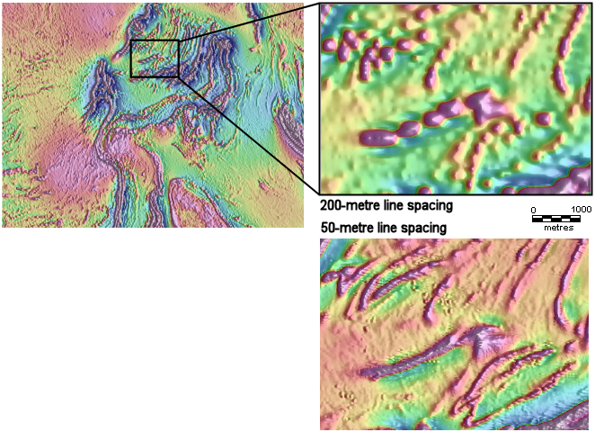
Detail of Kaustinen area total magnetic field (nT). The picture on the left is total magnetic field map of KKJ map sheet 2323. The two smaller maps show the comparison between the two line spacings.

