Sponsoring companies
![]()
![]()
![]()
![]()
Mineral Prospectivity Modeller, MPM-project
| Project name: | Mineral Prospectivity Modeller |
| Project host institution: | Geological Survey of Finland |
| Project management: | Vesa Nykänen, Research Professor, PhD., vesa.nykanen gtk.fi gtk.fiMaarit Middleton, Senior Scientist, D.Sc., maarit.middleton  gtk.fi gtk.fiP.O. Box 77, 96101 Rovaniemi, Geological Survey of Finland |
| Duration: | 2016-2018 |
| Keywords: | mineral exploration, mineral prospectivity modelling, GIS analysis, spatial analysis |
| Funding organizations: | Finnish Funding Agency for Technology and Innovation, AA Sakatti Mining Oy, Agnico Eagle Finland Oy, Boliden Mineral AB, Kenex Pty Ltd, De Beers Group Services (Pty) Ltd, Sakumpu Exploration Oy, The Second Institute of Oceanology (China) |
| Supporting organizations: | ESRI, U.S. Geological Survey, Geological Survey of Canada and University of Campinas |
Enhanced data-analysis techniques are essential due to increasing amount of digital data collected during mineral exploration. The expanding mineral exploration and mining activity set demand for the development of time-saving, cost-effective and environmentally neutral exploration techniques.
The project Mineral Prospectivity Modeller (MPM) investigates and implements new workflows and tools for mineral prospectivity modeling. To support strategic planning of companies, the project produces an on-line prospectivity modeller for the most prospective areas making land claims for further target scale exploration. To support target scale mineral exploration, a public Spatial Data Modeler toolbox is redesigned and recoded into ArcGIS for the use of consulting and exploration companies. The use of the tool will be demonstrated in a case study with real exploration data. Exploration in Lapland is promoted by distributing a free exploration dataset from northern Finland with the tool. The results of the project will be published in a report of investigation and scientific papers.
Three tasks will be accomplished in the MPM project
Task 1: ArcSDM) To support target scale mineral exploration, a public Spatial Data Modeler (SDM, viite Raines et al) toolbox is redesigned and recoded into ArcGIS for the use of consulting and exploration companies. Exploration in Lapland is promoted by distributing a free exploration dataset from northern Finland with the tool.
Task 2: MPM online tool) To support strategic planning of companies, the project produces a GIS-based online prospectivity modeller. The tool can be used to detect the most prospective areas companies to make claims for further target scale exploration.
Task 3: Dynamic modelling) The use of the ArcSDM tool will be demonstrated in a case study with real exploration data. The results of the project will be published in a report of investigation and scientific papers.
The project is solely carried out by GTK and funded by the Tekes-EAKR program Business from digitalization and internationally by exploration industry. Tekes funds 90% and companies 10% of the total of 500,000 euro budget for the years 2016-2018.
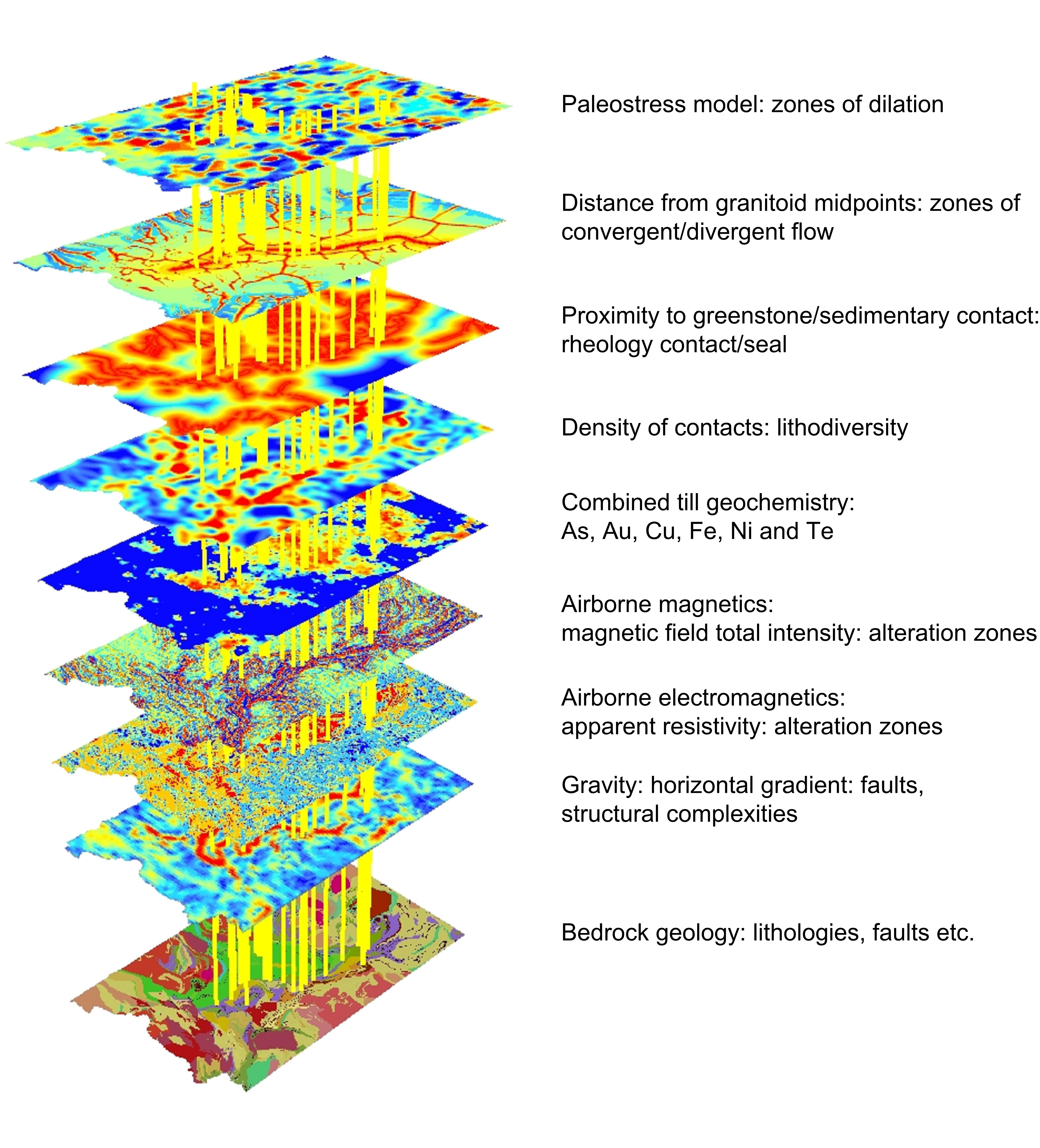
Mineral prospectivity mapping utilizes data integration capabilities of geographical information systems (GIS).


